
The Alpine region is currently experiencing a prolonged period of high-pressure dominance, resulting in unseasonably warm temperatures and a shift toward classic spring skiing conditions across all major high-altitude resorts. As of April 7, 2026, meteorological data indicates that a robust high-pressure system is centered over Central Europe, pushing the freezing level to altitudes exceeding 3,000 meters. This atmospheric setup has created a distinct diurnal cycle for skiers and snowboarders, characterized by hard-packed icing in the early morning hours and a rapid transition to "corn" or "slush" snow by midday. While the current conditions favor high-altitude resorts and north-facing slopes, a significant shift in the weather pattern is anticipated toward the end of the week, potentially bringing colder air and fresh precipitation to the southern reaches of the mountain range.

Current Meteorological Overview and the Freeze-Thaw Cycle
The prevailing weather pattern in the Alps is dictated by a stable ridge of high pressure that has brought clear skies and significant solar radiation to the slopes. With the isotherm—the altitude at which temperatures drop below zero degrees Celsius—climbing above 3,000 meters, only the highest peaks and glaciers are maintaining sub-freezing temperatures throughout the day. This has necessitated a strategic approach to mountain navigation for enthusiasts.
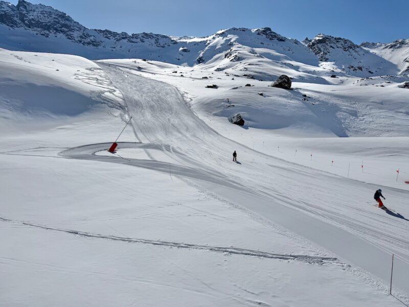
During the overnight hours, clear skies allow for effective long-wave radiation, which cools the snow surface and creates a firm, often icy crust. As the sun rises, the intensity of April’s solar radiation, combined with the high ambient air temperatures, causes the top layer of the snowpack to melt. This process creates what is known in the industry as "spring snow" or "corn snow"—a granular, soft surface that offers excellent grip and maneuverability if timed correctly. However, as the afternoon progresses, the melt-water can penetrate deeper into the snowpack, leading to heavy, "suction-like" conditions at lower elevations, which can increase the physical demand on skiers and heighten the risk of lower-limb injuries.
Regional Resort Analysis: France, Switzerland, and Italy
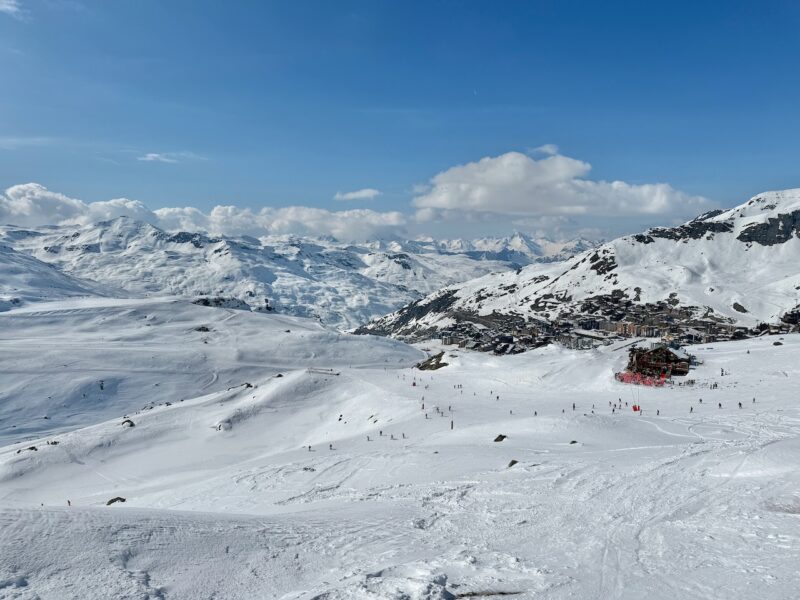
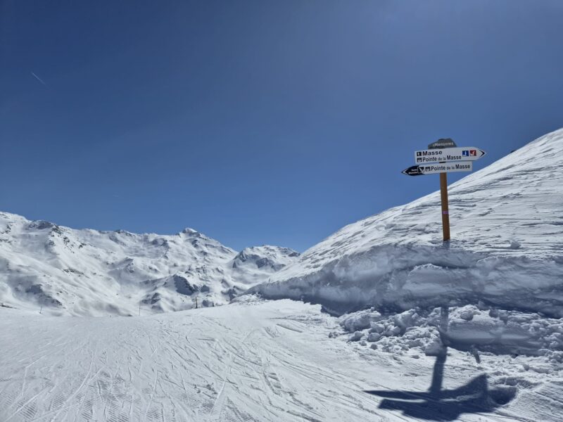
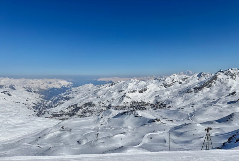
In France, high-altitude resorts in the Tarentaise Valley remain the primary beneficiaries of the current snowpack. Val Thorens, situated at 2,300 meters, continues to report a healthy late-season base. Reports from the ground indicate that while lower-altitude runs in the Les Menuires sector are beginning to show the effects of the warm spell, the higher north-facing sectors are holding firm. Fraser Wilkin, a prominent analyst from weathertoski.co.uk, noted that there remains a "very healthy late-season base in most high resorts," with coverage extending to relatively low altitudes in certain northern Alpine regions due to heavy snowfall earlier in the season.
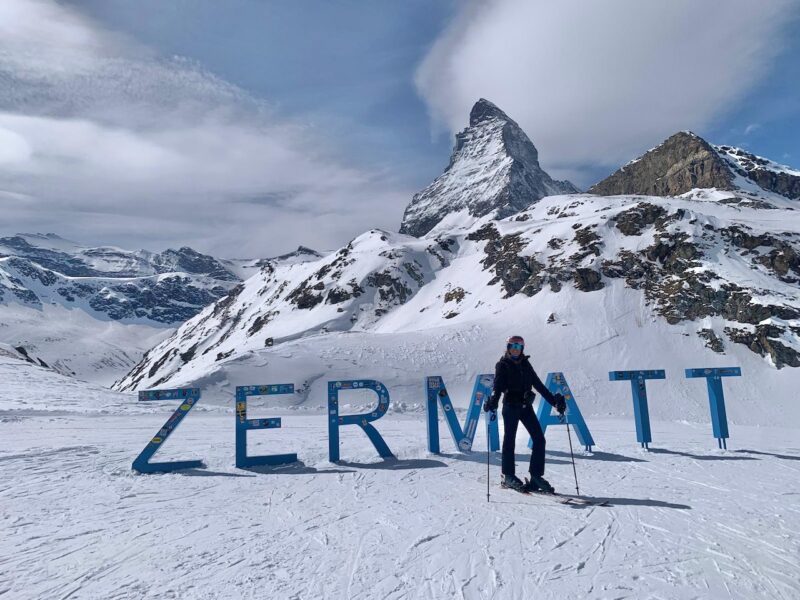
Switzerland is seeing similar trends, particularly in Zermatt, where the high-altitude glacier skiing remains a focal point for late-season visitors. The altitude of the Matterhorn Glacier Paradise, reaching up to 3,883 meters, ensures that snow quality remains more consistent than in lower-lying Valais resorts. However, even in these high-altitude havens, the impact of the 3,000-meter freezing level is evident on south-facing runs by mid-morning.
In Italy, Cervinia remains a top-tier option for April skiing. Its high-altitude plateau and connection to the Swiss Zermatt system provide some of the most reliable conditions in the Southern Alps. Current observations suggest that the Italian side of the Matterhorn is benefiting from the same high-pressure stability, though the southern exposure of many Italian slopes means the window for optimal skiing is slightly earlier in the day compared to the French or Austrian north-facing counterparts.
Safety Concerns and Avalanche Risk Assessment
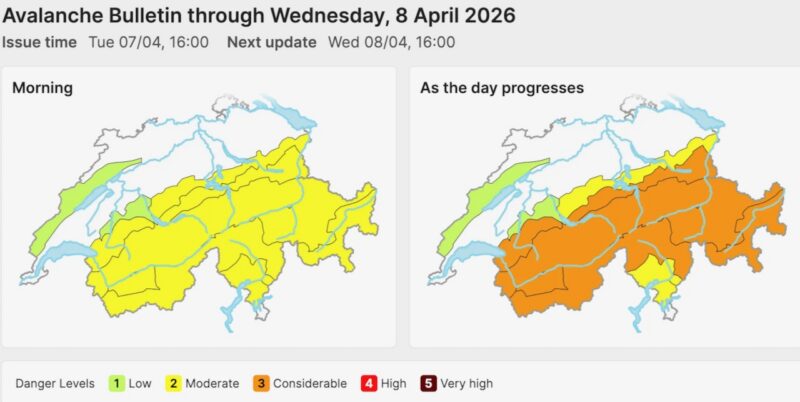
The transition to spring conditions has brought a critical increase in avalanche danger, particularly regarding "wet snow" avalanches. The Swiss Institute for Snow and Avalanche Research (SLF) and other national monitoring bodies have maintained a "considerable" (Level 3 on the European five-point scale) risk rating for many parts of the Alps. This danger typically increases throughout the day as solar radiation and rising temperatures weaken the bonds within the snowpack.
The safety situation has been underscored by a tragic Easter weekend, which saw eight avalanche-related fatalities across Europe. These incidents highlight the volatile nature of the spring snowpack, where layers of older, dry snow can become lubricated by melt-water, leading to full-depth or glide-snow avalanches. Safety experts are advising off-piste skiers to conclude their activities by midday and to seek the guidance of professional local guides if venturing onto high north-facing slopes, where isolated stashes of older powder may still exist but are increasingly difficult to locate and assess for stability.
The Rise of Andorra and the Nordic Outlook
While the Alps dominate the headlines, the 2026 season has seen an unexpected leader in terms of snow depth. Arcalis in Andorra currently claims the deepest snow in Europe, reporting a staggering four meters at its highest elevations. This anomaly is the result of specific Atlantic weather systems that favored the Pyrenees earlier in the spring, providing a robust base that is currently outperforming many traditional Alpine heavyweights.
In Northern Europe, Norway’s Gausta region has also reported strong late-season conditions. The Nordic climate, typically colder than the Alpine range, has preserved the snowpack more effectively through the Easter period. The Norwegian resorts offer a different profile for late-season skiers, with lower elevations but higher latitudes providing a more consistent, albeit shorter, day of skiing compared to the intense thermal fluctuations currently seen in France and Switzerland.
Short-Term Forecast and Season Outlook
The current warm spell is forecasted to conclude by the end of the week as the high-pressure system begins to break down. Meteorological models suggest an approaching cold front that will lower the freezing level and bring unsettled weather over the weekend. For the southern Alps, this could manifest as significant fresh snowfall, providing a much-needed "refresh" for the final four weeks of the season.
Resorts that have invested in high-altitude infrastructure and snowmaking are well-positioned to remain open through late April and into early May. The 2025-2026 season has been characterized by strong mid-winter snowfall, which has provided the thermal mass necessary for the snowpack to withstand the current warm period. However, the quality of the skiing for the remainder of the month will be highly dependent on the timing of the forecasted cold fronts and the ability of resorts to manage the "freeze-thaw" cycle on groomed runs.
Broader Implications for the Ski Industry
The current conditions in the Alps reflect a broader trend in the winter sports industry: the increasing importance of altitude and north-facing terrain. As spring temperatures become more variable, the economic viability of lower-altitude resorts is increasingly tied to their ability to provide high-altitude access or alternative spring activities.
For travelers planning a final trip of the season, the data suggests a clear strategy: "head high." The discrepancy between the skiing quality at 1,500 meters and 2,500 meters has never been more pronounced. Furthermore, the emphasis on safety cannot be overstated. With the avalanche risk remaining "considerable," the industry is seeing an increased demand for educational resources and guided experiences, as skiers navigate the complexities of a warming snowpack.
Summary of Key Data Points (April 7, 2026):
- Freezing Level: Currently exceeding 3,000m across most of the Alps.
- Peak Snow Depth: Arcalis, Andorra (4m at peak).
- Avalanche Risk: Level 3 (Considerable) in Switzerland and parts of France/Austria, particularly in the afternoon.
- Season Duration: Approximately four weeks remaining for major high-altitude resorts.
- Best Terrain: North-facing slopes above 2,500m; early morning sessions on groomed runs.
- Upcoming Change: Colder conditions and unsettled weather forecast for the weekend of April 11-12.
The 2026 spring season serves as a reminder of the dynamic nature of mountain environments. While the warmth offers a pleasant atmosphere for après-ski and sunshine on the terraces, it demands a disciplined and informed approach to the sport itself. The anticipated return of colder weather later this week offers hope for a high-quality conclusion to what has been a generally successful season for the European ski industry. Enthusiasts are encouraged to monitor local bulletins closely, as the transition from a high-pressure system to an unsettled front can bring rapid changes in visibility and surface stability.