
Thousands of autonomous robotic sentinels drift through the world’s oceans, quietly recording the pulse of our planet. These devices, known as Argo floats, provide the foundational data necessary for modern meteorology, climate modeling, and maritime safety. However, this critical global infrastructure—a program that has revolutionized oceanography since its inception in 1999—is now facing a severe financial crisis. As funding from the National Science Foundation (NSF) stalls and federal budget priorities shift under the current administration, the loss of this program threatens to leave the global scientific community blind to the very oceanic shifts that dictate the future of our weather and climate.
The Mechanism of Global Forecasting
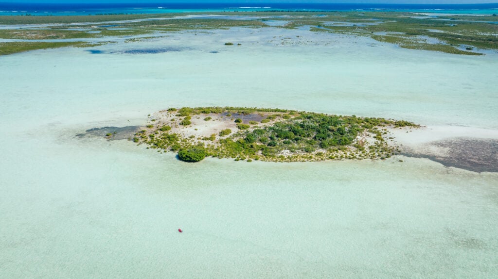
To understand the importance of the Argo program, one must look at the Pacific Ocean near the Palmyra Atoll. A temperature deviation of just one degree Celsius in this remote region—a change nearly imperceptible to the human eye—serves as a high-stakes signal for atmospheric behavior thousands of miles away. When water temperatures rise in this specific corridor, the heat radiates upward, lowering surface atmospheric pressure. This shift alters the trajectory of the jet stream, directly influencing where snow will fall in the Rocky Mountains or where droughts may plague agricultural heartlands months later.
Normally, the Pacific trade winds circulate from east to west, acting as a cooling mechanism for the region. When these winds falter, a feedback loop ensues: warmer water accumulates, the pressure balance is disrupted, and the trade winds weaken further. This process, often linked to El Niño cycles, is precisely the type of event that the Argo fleet is designed to detect in real-time. Without the granular, subsurface data provided by these floats, meteorologists are forced to rely on satellite surface observations, which lack the depth-specific insights required for accurate long-range modeling.
A Chronology of the Argo Program
The Argo program was conceived in the late 1990s as an ambitious international effort to create a persistent, real-time observation network. By the early 2000s, the first floats were deployed, marking a shift away from the historically expensive and logistically difficult method of using research vessels to gather data.
- 1999: The Argo program is formally established, aiming to deploy thousands of robotic profilers globally.
- 2000–2010: The fleet reaches its initial target of 3,000 active floats, providing the first comprehensive global map of ocean temperature and salinity.
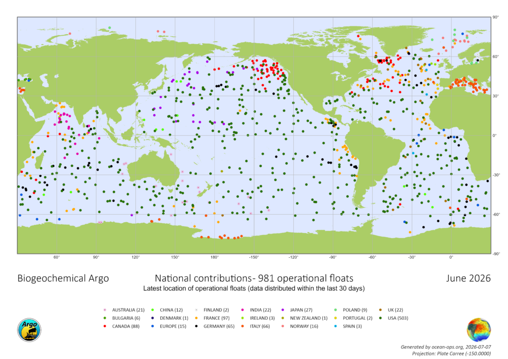
- 2010–2020: The program expands to include BGC (Biogeochemical) Argo floats, capable of measuring oxygen, pH, nitrate, and chlorophyll levels. Deep Argo floats are introduced, reaching depths of up to four miles.
- 2024–2025: Significant shifts in U.S. federal budget priorities lead to a 50 percent reduction in oceanographic grant availability.
- 2026: A critical five-year NSF grant for the maintenance of 500 BGC-Argo floats expires. Despite a funding application submitted over 20 months ago, no renewal or communication has been received, leaving the future of the program in a state of suspended animation.
The Technical and Economic Value of Ocean Profiling
The cost-efficiency of the Argo fleet is unparalleled in modern science. A single profile—a measurement cycle where a float descends to depth and rises to the surface while recording data—costs approximately $200. When compared to the hundreds of thousands of dollars required to equip, staff, and fuel a dedicated research vessel for a single voyage, the Argo network represents a massive return on investment.
Data from the 4,000-strong fleet is transmitted via satellite and made available to the public within 24 hours. This data supports over 500 peer-reviewed scientific publications annually. According to Dr. Shawnee Traylor, a chemical oceanographer, this information is not merely academic; it is foundational to public safety. "The ocean stores the bulk of heat and moisture that drives our weather," Dr. Traylor explains. "Satellites capture the surface, but forecasters need that subsurface picture to understand what’s brewing below."
The implications for global climate change are equally profound. The ocean absorbs approximately 30 percent of human-generated CO2 emissions. As the water absorbs this heat, it undergoes thermal expansion, which is responsible for roughly one-third of observed global sea-level rise. Research facilitated by Argo data has quantified this intake, leading to the startling realization that the ocean is absorbing heat at a rate equivalent to the detonation of 12 atomic bombs per second.
The Crisis of Funding and Political Climate
The current threat to the Argo program is symptomatic of a broader contraction in government-funded climate research. Following the administration’s redirection of fiscal priorities, research grants for oceanography have been halved since 2025. This has resulted in an immediate halt to the construction of new U.S.-made floats.
The scientific community warns that the consequences of this neglect will not be immediate, but they will be inevitable. As the existing fleet reaches its end-of-life cycle and stops transmitting, the "data gaps" will grow. Dr. Traylor warns, "Data quality will start degrading, and within a couple of years, that will show up downstream as less reliable forecasts for extreme weather events."
The inability to track ocean acidification, oxygen depletion, and heat content in real-time will severely hinder the ability of coastal nations to prepare for intensified hurricane seasons and shifting maritime ecosystems. Fisheries, which rely on precise temperature data to track fish stocks, will also see their predictive modeling capabilities diminished.
Legislative Precedents and the Path Forward
There is a potential pathway for the survival of the Argo program, modeled after recent successes in Congress. In mid-2026, the Ocean Observatories Initiative (OOI)—another critical maritime research program—faced a similar threat of dismantling. A bipartisan group of 11 U.S. Senators, led by Jeff Merkley (D-OR) and Lisa Murkowski (R-AK), intervened to protect the funding, citing the program’s essential role in public safety and national security.
In a letter addressed to the NSF, the senators argued that dismantling established, successful research networks is a direct threat to national infrastructure. "The effort to dismantle this vital network, jeopardizing decades of prior research, must be reversed in order to prioritize public safety," the letter stated.
Advocates for the Argo program are now looking for similar bipartisan support. They argue that the issue transcends party lines, as the data provided by Argo is utilized by the military, commercial shipping, weather services, and agricultural planners alike. The challenge lies in translating the technical necessity of the program into the legislative urgency required to unlock the pending grants.
Broader Implications for Global Stability
The potential loss of the Argo fleet represents more than just a reduction in scientific output; it represents the loss of a primary warning system. In an era where extreme weather events are becoming more frequent and severe, the ability to forecast these events with precision is a prerequisite for economic and physical stability.
The ocean, once considered a vast and immutable force, is changing at an unprecedented pace. By choosing to let the Argo network languish, policymakers are effectively choosing to navigate the coming decades with a significant portion of the planet’s vital statistics missing. As the international community weighs the costs of maintenance against the risks of inaction, the silent sentinels of the Pacific continue to drift—providing the world with one last look at the hidden, warming currents that will define the climate of the future. The question remains whether the political will exists to ensure that these robots continue to speak for the ocean, or if the scientific community will be forced to drift into the dark.