
As the crisp air of winter descends across North America, skiers and snowboarders eagerly anticipate the season’s first snowflakes. Yet, beneath the surface of powder forecasts lie complex atmospheric and oceanic phenomena that significantly influence where the snow will fall. Two of the most influential are El Niño and La Niña, often discussed by meteorologists but frequently misunderstood by the public. While the intricate science behind sea surface temperatures and atmospheric pressure patterns can be daunting, the practical implication for winter enthusiasts is straightforward: these events dramatically shift the odds for snowfall across different regions of the continent.
At its core, the distinction lies in the behavior of the equatorial Pacific Ocean. El Niño is characterized by a warming of these waters, while La Niña represents a cooling. These shifts are not isolated events but rather the ebb and flow of a naturally occurring climate pattern known as the El Niño-Southern Oscillation (ENSO). This cycle has a profound impact on global weather, and its effects are particularly pronounced on North American winter conditions. Understanding these patterns is crucial for predicting which mountain ranges are most likely to be blanketed in deep powder.
La Niña: A Northern Embrace of Winter’s Bounty
Generally, a La Niña pattern tends to steer the primary winter storm track further north across North America. This northward shift often translates into more frequent storm systems, colder temperatures, and lower snow levels for regions situated in the northern latitudes. For skiers and snowboarders, this typically means favorable conditions in the Pacific Northwest, British Columbia, and the northern Rocky Mountains.
British Columbia: A Consistent Beneficiary
British Columbia often emerges as a clear winner during La Niña winters. The prevailing storm track frequently directs Pacific moisture inland, delivering substantial snowfall to the majestic Coast Mountains and the diverse interior ranges. Ski resorts in areas like Whistler, Revelstoke, and Fernie, along with numerous other destinations across western Canada, tend to experience enhanced snowfall when the northern storm track becomes particularly active. Data from organizations like NOAA’s Climate Prediction Center consistently shows a correlation between La Niña events and above-average precipitation in this region. For example, historical analysis has indicated that during strong La Niña years, snowfall departures from average in parts of British Columbia can be significantly positive, leading to extended seasons and deep powder.
Washington and Oregon: Cascades Blessed with Cold and Snow
The iconic Cascade Mountains of Washington and Oregon also frequently benefit from La Niña’s influence. These states often see a steady stream of Pacific storms, and critically, the colder temperatures associated with La Niña ensure that precipitation falls as snow rather than rain, especially at lower elevations. This is a crucial factor for ski areas that might otherwise struggle with marginal snow conditions. The National Weather Service’s Inland Northwest office has reported that La Niña winters in this region are often characterized by cooler-than-normal temperatures, above-normal precipitation, and consequently, above-normal snowfall. This pattern can significantly boost the economic prospects for ski resorts and local communities that rely on winter tourism.
Northern Idaho and Montana: Rockies Revel in Pacific Moisture
The northern U.S. Rocky Mountains, encompassing areas of northern Idaho and Montana, also historically experience more favorable conditions under La Niña. Storms originating from the Pacific Northwest and western Canada frequently deliver consistent snowfall throughout the winter season. Resorts such as Whitefish in Montana and Schweitzer and Lookout Pass in Idaho are often well-positioned to capitalize on this northern storm pattern, leading to reliable snow bases and exciting ski conditions. This consistent snowfall can be a vital economic driver for these mountainous regions, supporting local businesses and employment.
The Canadian Rockies: A Mixed but Often Favored Landscape
While snowfall can vary considerably between specific ranges within the Canadian Rockies, the region generally benefits from La Niña patterns, particularly when cold air masses combine with Pacific moisture reaching Alberta and eastern British Columbia. While not always as pronounced as in the Pacific Northwest, La Niña typically offers better odds for snowfall across the Canadian Rockies compared to El Niño. This can mean more consistent conditions for popular destinations like Banff, Lake Louise, and Jasper.
The Great Lakes: A Lake-Effect Snow Bonanza
La Niña’s influence extends beyond the western mountains, often bringing more frequent cold-air outbreaks across the northern United States. When these frigid air masses sweep over the relatively warmer waters of the Great Lakes, they can trigger significant lake-effect snow events. This phenomenon can boost snowfall totals in parts of Michigan, Wisconsin, Ontario, and western New York. While the precise location and intensity of lake-effect snow are heavily dependent on wind direction and atmospheric conditions, La Niña provides the crucial cold environment that fuels these prolific snow bands. For communities near the Great Lakes, this can mean a significant boost in winter recreation opportunities and related economic activity.
Alaska: A Colder, Stormier Winter
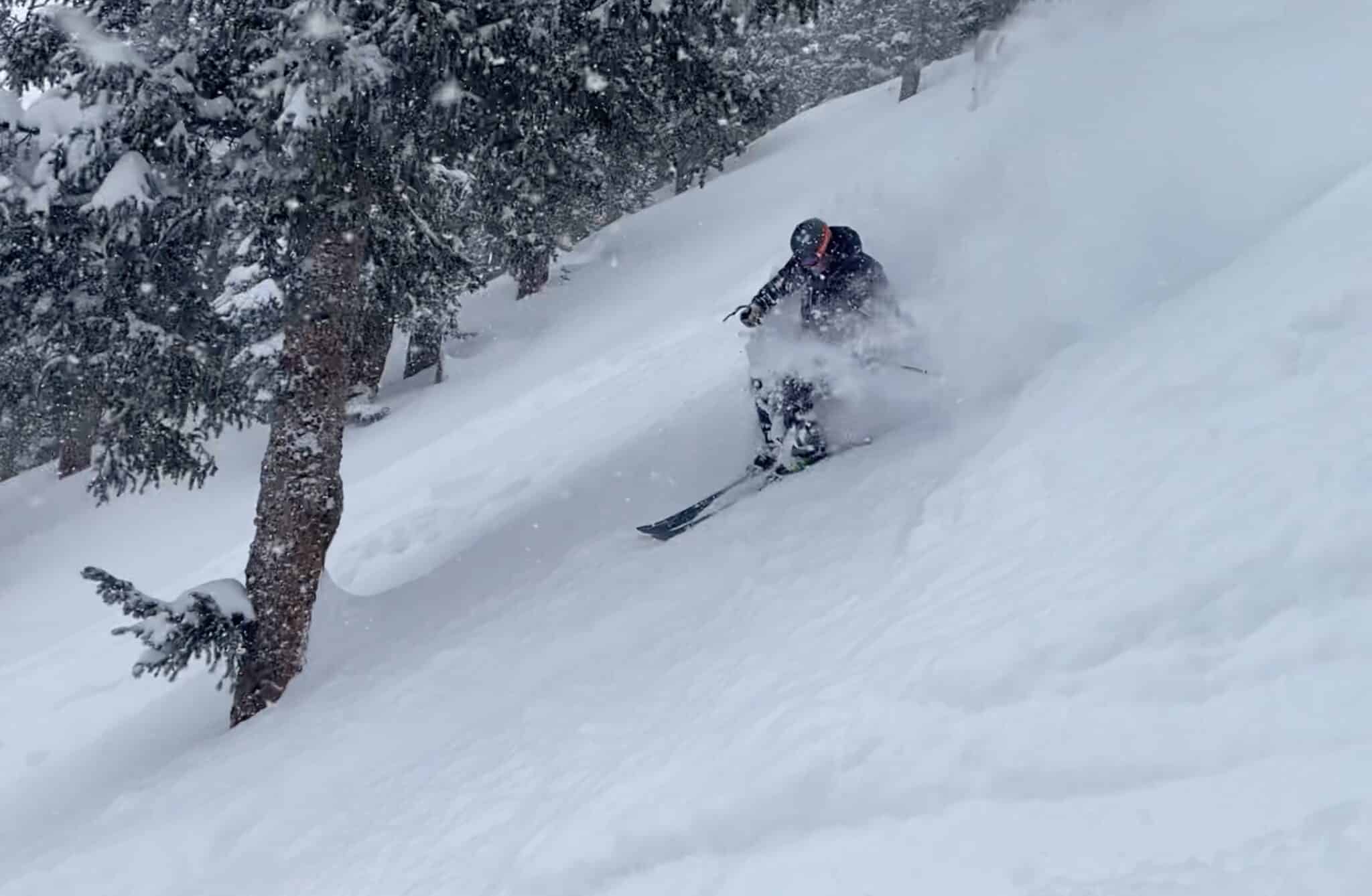
Parts of Alaska can also experience a colder and more active storm pattern during La Niña. Southern Alaska and its coastal mountain ranges may see increased snowfall as storms repeatedly move through the Gulf of Alaska. This can be particularly beneficial for resorts and communities in regions like Juneau and Anchorage, contributing to longer ski seasons and more reliable snowpack.
El Niño: Shifting the Storm Track Southward
In contrast to La Niña, El Niño commonly influences North American winters by shifting the primary storm track farther south. This southward migration of storm systems can significantly improve the likelihood of major snow events across California, Arizona, New Mexico, and portions of the southern Rocky Mountains.
California and the Sierra Nevada: High Hopes for Deep Powder
California, and particularly the Sierra Nevada mountain range, garners significant attention during El Niño winters. When strong El Niño patterns emerge, Pacific storms can batter the Sierra Nevada, leading to prodigious snowfall totals at higher elevations. The arrival of powerful atmospheric rivers during these periods can dramatically transform a season, turning what might have been a dry winter into a powder-filled paradise. A key variable, however, remains temperature. Warm storms can bring rain to lower elevations while simultaneously dumping feet of snow at higher altitudes, a phenomenon that skiers understand can lead to exceptional base depths near the mountain crest.
One long-time Tahoe skier recounted, "I remember California winters that looked nearly hopeless until one storm cycle changed everything. The Sierra can go from dry to buried remarkably fast." While El Niño does not guarantee a massive California winter, it demonstrably improves the odds compared to La Niña. NOAA’s analysis of strong El Niño winters has historically shown a tendency for wetter-than-normal conditions along much of the West Coast and the southern tier of the United States, a pattern that often translates into significant snow for the Sierra Nevada.
Arizona and New Mexico: Southwest Snowfall Opportunities
Arizona and New Mexico often find themselves on the drier side during La Niña years, as the main storm track bypasses the Southwest. El Niño, however, can bring a more active storm pattern through this region, increasing the chances of snowfall in the higher mountain ranges. Ski areas in northern Arizona and New Mexico, such as those near Flagstaff and Taos, generally look forward to El Niño as a harbinger of better snow conditions. This can be critical for these smaller ski destinations that rely heavily on winter tourism.
Southern Utah: A Southern Shift for the Beehive State
Southern Utah can also experience enhanced snowfall when El Niño directs storms through California and the Southwest. Mountains like Brian Head may see more frequent opportunities for snow, while northern Utah might remain outside the direct path of the heaviest precipitation. This localized difference within a state highlights the nuanced impact of ENSO.
Southern Colorado: The San Juans Shine
The majestic San Juan Mountains of southwestern Colorado frequently perform well during El Niño winters. Storm systems tracking along the southern storm track often favor this region, bringing beneficial snow to areas around Wolf Creek Pass, Telluride, Purgatory, and Silverton. It is crucial to note, however, that this does not mean all of Colorado experiences equal benefits. As one expert noted, "The mistake people make is talking about Colorado or the Rockies as though every mountain gets the same weather. A pattern that buries the San Juans can leave northern Colorado waiting for snow." This emphasizes the importance of regional specificity within broader climate patterns.
Utah and Colorado: Caught in the Middle
The states of Utah and Colorado occupy a unique position, often falling into a transitional zone where their winter weather can be influenced by both El Niño and La Niña, albeit with different regional biases. Northern Utah and northwestern Colorado may see increased snowfall during La Niña events as storms track through the northern Rockies. Conversely, southern Utah and southwestern Colorado tend to have better odds of significant snowfall during El Niño years when storms favor the southern storm track. This geographic dichotomy means that a statewide winter forecast can be misleading, as two ski areas within the same state might experience vastly different seasonal outcomes.
The Northeast: A Complex Equation
The Northeast United States presents a more complex scenario, lacking a simple, direct correlation with either El Niño or La Niña. While El Niño can provide the moisture for large coastal storms, the critical factor for snowfall is the presence of sufficiently cold air. Without this cold air, the precipitation often falls as rain, even during a strong El Niño. La Niña, on the other hand, can bring colder air to the region, but storm tracks may frequently skirt the East Coast, leading to rain in major metropolitan areas while northern New England receives snow.
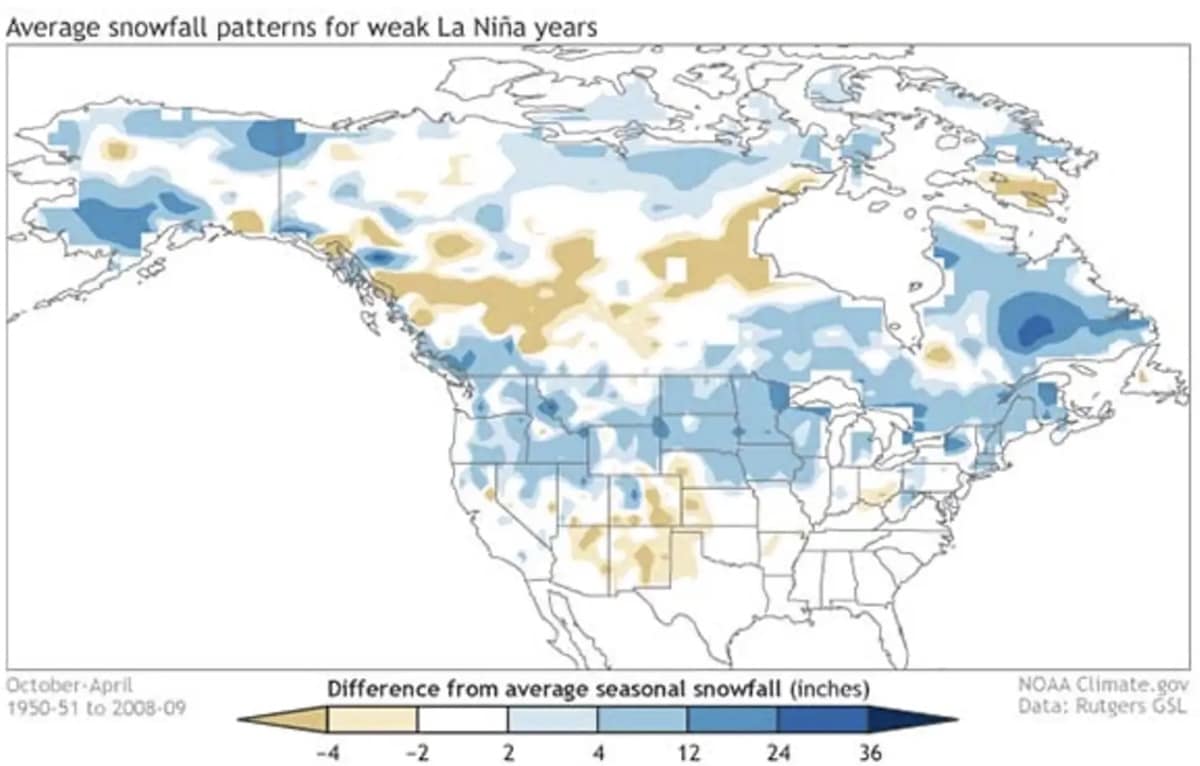
Historical analyses by NOAA have indicated that El Niño frequently reduces seasonal snowfall around the Great Lakes, northern Rockies, Pacific Northwest, and parts of interior New England. For the Northeast, the precise track and timing of individual storms often play a more significant role in determining snowfall totals than the broader ENSO pattern. This variability makes long-term forecasting for the region particularly challenging.
El Niño vs. La Niña Snowfall Cheat Sheet: A Regional Overview
To provide a clearer picture, here is a summary of the general snowfall tendencies associated with El Niño and La Niña across North America:
| Region | Pattern that usually offers better snow odds |
|---|---|
| British Columbia | La Niña |
| Washington and Oregon | La Niña |
| Northern Idaho | La Niña |
| Montana | La Niña |
| Canadian Rockies | La Niña |
| Alaska | Often La Niña |
| Great Lakes snowbelts | Often La Niña |
| Sierra Nevada (California) | El Niño |
| Arizona | El Niño |
| New Mexico | El Niño |
| Southern Utah | Often El Niño |
| Southern Colorado | Often El Niño |
| Northern Utah | Mixed, sometimes La Niña |
| Northern Colorado | Mixed |
| Northeast | Highly variable |
The Simple Version: North vs. South
For those seeking a simplified understanding, the general rule of thumb is as follows:
La Niña usually favors:
- The Pacific Northwest
- British Columbia
- The northern Rockies
El Niño usually favors:
- California
- The Southwest (Arizona, New Mexico)
- Parts of the southern Rockies
The hardest regions to predict:
- The Northeast
- The central Rockies (Colorado, Utah) where the influence can be mixed depending on the specific location within the state and the nuances of the ENSO pattern.
NOAA’s extensive research, including detailed reviews of La Niña and North American snowfall, consistently points to northwestern and north-central portions of the continent exhibiting the strongest snowfall signals during La Niña events.
Neither Pattern Guarantees Snow: The Nuances of Winter Weather
It is imperative to understand that neither El Niño nor La Niña guarantees a specific snowfall outcome. These patterns merely alter the probabilities. A La Niña winter can still be disappointing in Washington, and an El Niño winter can still be dry in California. Numerous other factors come into play, including the strength and trajectory of atmospheric rivers, short-term jet stream fluctuations, the temperature of incoming storms, the elevation of the ski resort, and the precise path each storm system takes.
A few strategically timed, major storms can salvage an otherwise lackluster season. Conversely, a warm storm can bring rain to the base of a mountain while dumping significant powder at the summit. The variability is immense; one mountain can be buried in snow while another just a few hours away receives very little.
As one seasoned meteorologist explained, "ENSO can tell you which regions might have the advantage, but it cannot tell you where the best skiing will be three months from now. The best strategy has always been to stay flexible and follow the snow." This sentiment underscores the most critical takeaway for any winter enthusiast: while understanding ENSO provides valuable probabilistic insights, the ultimate determinant of excellent skiing conditions remains the actual weather patterns that unfold throughout the season.
Therefore, while La Niña generally favors the north and El Niño generally favors the south, the ultimate beneficiaries of abundant snowfall are always the mountain ranges situated directly beneath the active storm tracks. For the latest insights and official updates, resources such as NOAA’s El Niño and La Niña page and the Climate Prediction Center’s ENSO discussion offer invaluable, up-to-date information.

